Geolocate

Riverside topographic map

Click on the map to display elevation.

About this map

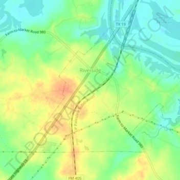
Name: Riverside topographic map, elevation, terrain.

Location: Riverside, Walker County, Texas, 77367, United States (30.83718 -95.41831 30.86109 -95.37810)

Average elevation: 180 ft

Minimum elevation: 121 ft

Maximum elevation: 246 ft

Walker County trails, hiking, mountain biking, running and outdoor activities

Other topographic maps

Click on a map to view its topography, its elevation and its terrain.

Dodge

United States > Texas > Walker County

Average elevation: 377 ft

Gear up for your next adventure:

🕶️Glacier Sunglasses - Side shields to protect eyes from high-altitude snow glare
🧷Carabiner Set - Durable clips for gear attachment
🗻Climbing Gear Basics - Essential gear for beginner climbers
🧤Hiking Gloves - Protective gloves for rugged trails
💧Water Filtration Bottles - Safely drink from streams and lakes while exploring

As an Amazon Associate, this site earns from qualifying purchases at no extra cost to you.