
Thank you for supporting this site ❤️
Make a donation
Make a donation
Gear up for your next adventure:
As an Amazon Associate, this site earns from qualifying purchases at no extra cost to you.
Moghrar topographic map
Click on the map to display elevation.
Thank you for supporting this site ❤️
Make a donation
Make a donation
Gear up for your next adventure:
As an Amazon Associate, this site earns from qualifying purchases at no extra cost to you.
About this map
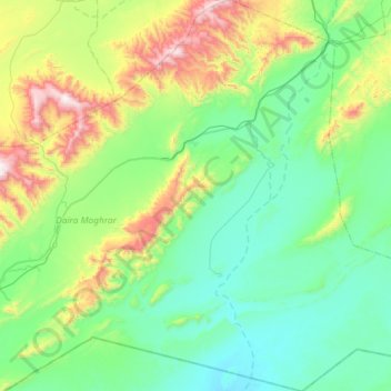
Name: Moghrar topographic map, elevation, terrain.
Location: Moghrar, Moghrar District, Naâma, Algeria (32.20191 -0.73187 32.69303 -0.15369)
Average elevation: 3,533 ft
Minimum elevation: 2,572 ft
Maximum elevation: 6,916 ft
Thank you for supporting this site ❤️
Make a donation
Make a donation
Gear up for your next adventure:
As an Amazon Associate, this site earns from qualifying purchases at no extra cost to you.