Geolocate

Flat Rock topographic map

Click on the map to display elevation.

About this map

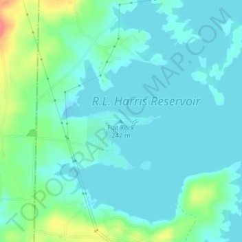
Name: Flat Rock topographic map, elevation, terrain.

Location: Flat Rock, Randolph County, Alabama, United States (33.28203 -85.63982 33.28213 -85.63972)

Average elevation: 830 ft

Minimum elevation: 784 ft

Maximum elevation: 994 ft

Randolph County trails, hiking, mountain biking, running and outdoor activities

Other topographic maps

Click on a map to view its topography, its elevation and its terrain.

Roanoke

United States > Alabama > Randolph County > Roanoke

Average elevation: 823 ft

Wadley

United States > Alabama > Randolph County

Average elevation: 686 ft

Woodland

United States > Alabama > Randolph County

Average elevation: 1,027 ft

Melody Lane

United States > Alabama > Randolph County > Roanoke

Average elevation: 860 ft

Gear up for your next adventure:

💧Water Purification System - Clean water on the trail with reliable purifiers
🚑Emergency Bivvies - Heat-reflective sleeping bags for survival situations
🛠️Backpacking Tool Kit - Essential toolkit for outdoor repairs
🪵Folding Camp Saw - Compact saw for wood and campsite work
🥾Women's Hiking Boots - Top-rated trail boots with ankle support and superior grip

As an Amazon Associate, this site earns from qualifying purchases at no extra cost to you.