
La Lécherette topographic map
Interactive map
Click on the map to display elevation.
About this map
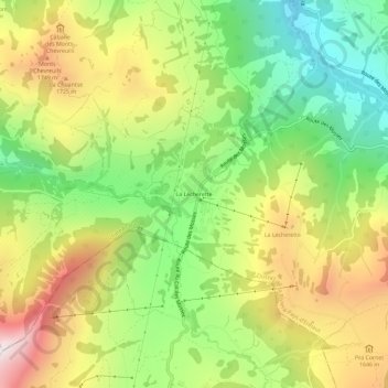
Name: La Lécherette topographic map, elevation, terrain.
Average elevation: 4,843 ft
Minimum elevation: 3,396 ft
Maximum elevation: 6,657 ft
Other topographic maps
Click on a map to view its topography, its elevation and its terrain.
Gérignoz
Suisse > Vaud > District de la Riviera-Pays-d’Enhaut > Château-d'Œx
Gérignoz, Château-d'Oex, District de la Riviera-Pays-d’Enhaut, Vaud, 1660, Suisse
Average elevation: 4,058 ft
L'Étivaz
Suisse > Vaud > District de la Riviera-Pays-d’Enhaut > Château-d'Œx
L'Étivaz, Château-d'Oex, District de la Riviera-Pays-d’Enhaut, Vaud, 1660, Suisse
Average elevation: 4,895 ft