
Lane Cove topographic map
Interactive map
Click on the map to display elevation.
About this map
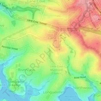
Name: Lane Cove topographic map, elevation, terrain.
Average elevation: 171 ft
Minimum elevation: 0 ft
Maximum elevation: 358 ft
Other topographic maps
Click on a map to view its topography, its elevation and its terrain.
Abbotsbury
Abbotsbury, Sydney, Fairfield City Council, 2176, Australia
Average elevation: 259 ft
Kensington
Kensington, Sydney, Randwick City Council, 2033, Australia
Average elevation: 102 ft