
Le Pouzat topographic map
Interactive map
Click on the map to display elevation.
About this map
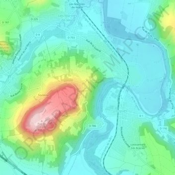
Name: Le Pouzat topographic map, elevation, terrain.
Average elevation: 1,296 ft
Minimum elevation: 1,066 ft
Maximum elevation: 2,031 ft
Other topographic maps
Click on a map to view its topography, its elevation and its terrain.
63730
France > Auvergne-Rhône-Alpes > Puy-de-Dôme > Corent
63730, Corent, Clermont-Ferrand, Puy-de-Dôme, Auvergne-Rhône-Alpes, France métropolitaine, France
Average elevation: 1,381 ft