
Niederbiel topographic map
Interactive map
Click on the map to display elevation.
About this map
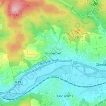
Name: Niederbiel topographic map, elevation, terrain.
Location: Niederbiel, Lahn-Dill-Kreis, Hesse, 35606, Germany (50.53619 8.37948 50.57619 8.41948)
Average elevation: 663 ft
Minimum elevation: 453 ft
Maximum elevation: 1,171 ft