
Rajampeta topographic map
Interactive map
Click on the map to display elevation.
About this map
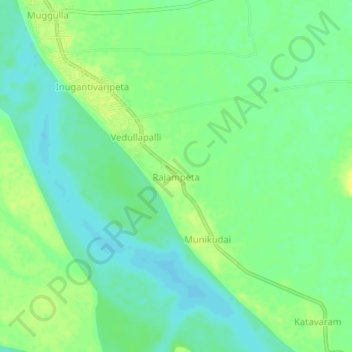
Name: Rajampeta topographic map, elevation, terrain.
Location: Rajampeta, Seethanagaram, East Godavari, Andhra Pradesh, India (17.10889 81.70188 17.14889 81.74188)
Average elevation: 66 ft
Minimum elevation: 36 ft
Maximum elevation: 98 ft
Other topographic maps
Click on a map to view its topography, its elevation and its terrain.
Purushottapatnam
India > Andhra Pradesh > Seethanagaram
Purushottapatnam, Seethanagaram, East Godavari District, Andhra Pradesh, 534315, India
Average elevation: 128 ft