
Selters topographic map
Interactive map
Click on the map to display elevation.
About this map
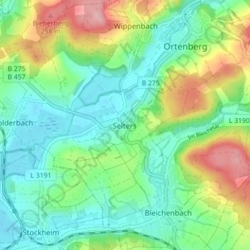
Name: Selters topographic map, elevation, terrain.
Location: Selters, Wetteraukreis, Hessen, 63683, Duitsland (50.32096 9.01774 50.36096 9.05774)
Average elevation: 564 ft
Minimum elevation: 407 ft
Maximum elevation: 902 ft