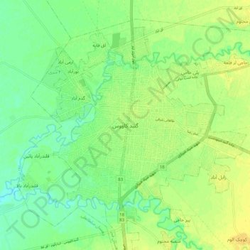
Gonbad-e Qabus topographic map
Interactive map
Click on the map to display elevation.
About this map
Name: Gonbad-e Qabus topographic map, elevation, terrain.
Average elevation: 131 ft
Minimum elevation: 95 ft
Maximum elevation: 167 ft

Click on the map to display elevation.
Name: Gonbad-e Qabus topographic map, elevation, terrain.
Average elevation: 131 ft
Minimum elevation: 95 ft
Maximum elevation: 167 ft