
Laayoune topographic map
Interactive map
Click on the map to display elevation.
About this map
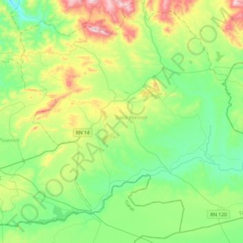
Name: Laayoune topographic map, elevation, terrain.
Location: Laayoune, Daïra Khemisti, Tissemsilt, Algérie (35.54209 1.94885 35.79460 2.28952)
Average elevation: 2,933 ft
Minimum elevation: 2,267 ft
Maximum elevation: 4,551 ft