
Jubrique topographic map
Interactive map
Click on the map to display elevation.
About this map
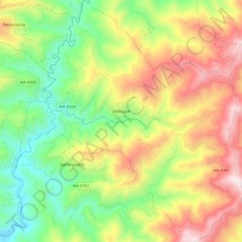
Name: Jubrique topographic map, elevation, terrain.
Location: Jubrique, Serranía de Ronda, Málaga, Andalucía, 29492, España (36.51864 -5.25671 36.60269 -5.16177)
Average elevation: 1,965 ft
Minimum elevation: 453 ft
Maximum elevation: 3,911 ft