
Heuberg topographic map
Interactive map
Click on the map to display elevation.
About this map
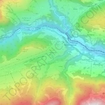
Name: Heuberg topographic map, elevation, terrain.
Location: Heuberg, Lend, Bezirk Zell am See, Salzburg, 5651, Oostenrijk (47.27744 13.00670 47.31744 13.04670)
Average elevation: 3,222 ft
Minimum elevation: 2,073 ft
Maximum elevation: 5,338 ft