
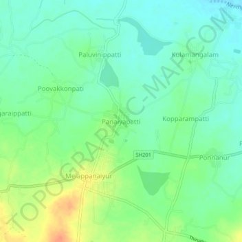
Panaiyapatti topographic map
Interactive map
Click on the map to display elevation.
About this map
Name: Panaiyapatti topographic map, elevation, terrain.
Average elevation: 381 ft
Minimum elevation: 331 ft
Maximum elevation: 469 ft
Other topographic maps
Click on a map to view its topography, its elevation and its terrain.
Adhanur
India > Tamil Nadu > Thirumayam taluk
Adhanur, Thirumayam taluk, Pudukkottai District, Tamil Nadu, 622503, India
Average elevation: 358 ft
Nemmeli
India > Tamil Nadu > Thirumayam taluk > Valarmanickam > Nemmeli
Nemmeli, Valarmanickam, Thirumayam taluk, Pudukkottai District, Tamil Nadu, India
Average elevation: 148 ft