
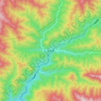
皇冠镇 topographic map
Interactive map
Click on the map to display elevation.
About this map
Name: 皇冠镇 topographic map, elevation, terrain.
Location: 皇冠镇, 宁陕县, 陕西省, 中国 (33.54902 108.34956 33.62902 108.42956)
Average elevation: 5,299 ft
Minimum elevation: 3,842 ft
Maximum elevation: 7,257 ft