Geolocate

Pico topographic map

Click on the map to display elevation.

About this map
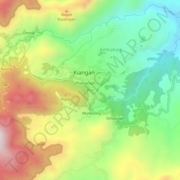
Name: Pico topographic map, elevation, terrain.

Location: Pico, Kiangan, Ifugao, Cordillera Administrative Region, 3604, Philippines (16.75525 121.06712 16.79525 121.10712)

Average elevation: 2,651 ft

Minimum elevation: 1,430 ft

Maximum elevation: 4,324 ft

Other topographic maps

Click on a map to view its topography, its elevation and its terrain.

Bilong

Philippines > Ifugao > Kiangan

Average elevation: 3,225 ft

Bilong

Philippines > Ifugao > Kiangan

Average elevation: 3,225 ft

Gear up for your next adventure:

🎒Trail Energy Bars - High‑calorie bars for hiking energy
📷Action Cameras - Rugged cameras to document your journeys across rugged terrain
❄️Traction Cleats - Prevent slips on icy trails during winter hikes
🪶Fire Starter Kit - Reliable fire starter for survival and camping
🌡️Handheld Weather Meters - Measure wind, temp, and pressure for safe mountain travel

As an Amazon Associate, this site earns from qualifying purchases at no extra cost to you.