
Casares topographic map
Interactive map
Click on the map to display elevation.
About this map
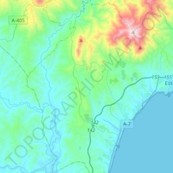
Name: Casares topographic map, elevation, terrain.
Location: Casares, Costa del Sol Occidental, Málaga, Andaluzia, Espanha (36.32507 -5.35805 36.52062 -5.20528)
Average elevation: 735 ft
Minimum elevation: 0 ft
Maximum elevation: 4,711 ft