
3e Ogé topographic map
Interactive map
Click on the map to display elevation.
About this map
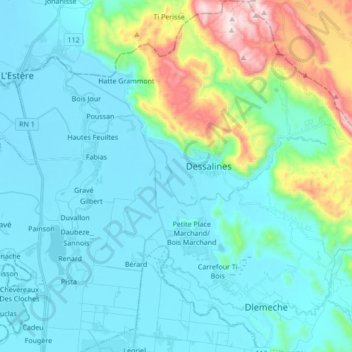
Name: 3e Ogé topographic map, elevation, terrain.
Average elevation: 443 ft
Minimum elevation: 13 ft
Maximum elevation: 2,461 ft
Other topographic maps
Click on a map to view its topography, its elevation and its terrain.
2e Fossé Naboth
Haiti > Artibonite Department > Commune de Dessalines
2e Fossé Naboth, Commune de Dessalines, Arrondissement de Dessalines, Artibonite Department, Haiti
Average elevation: 115 ft