
Zawiercie topographic map
Interactive map
Click on the map to display elevation.
About this map
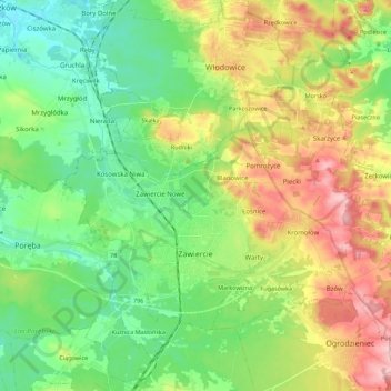
Name: Zawiercie topographic map, elevation, terrain.
Location: Zawiercie, Zawiercie County, Silesian Voivodeship, Poland (50.45683 19.35933 50.55440 19.58153)
Average elevation: 1,158 ft
Minimum elevation: 955 ft
Maximum elevation: 1,512 ft