
Ouled Aissa topographic map
Interactive map
Click on the map to display elevation.
About this map
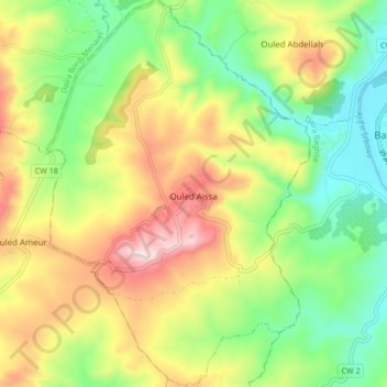
Name: Ouled Aissa topographic map, elevation, terrain.
Location: Ouled Aissa, Daïra Naciria, Boumerdès, Algérie (36.77256 3.78198 36.84060 3.83973)
Average elevation: 633 ft
Minimum elevation: 7 ft
Maximum elevation: 1,509 ft
Other topographic maps
Click on a map to view its topography, its elevation and its terrain.
Boumraou
Algérie > Boumerdès > Daïra Naciria > Naciria
Boumraou, Naciria, Daïra Naciria, Boumerdès, Algérie
Average elevation: 650 ft
Naciria
Algérie > Boumerdès > Daïra Naciria
Naciria, Daïra Naciria, Boumerdès, Algérie
Average elevation: 974 ft