
Thank you for supporting this site ❤️
Make a donation
Make a donation
Gear up for your next adventure:
As an Amazon Associate, this site earns from qualifying purchases at no extra cost to you.
Aosta topographic map
Click on the map to display elevation.
Thank you for supporting this site ❤️
Make a donation
Make a donation
Gear up for your next adventure:
As an Amazon Associate, this site earns from qualifying purchases at no extra cost to you.
About this map
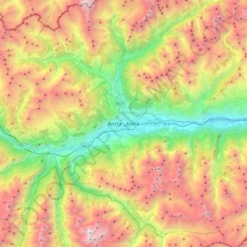
Name: Aosta topographic map, elevation, terrain.
Location: Aosta, Aosta / Aoste, Aosta Valley, 11100, Italy (45.57709 7.15966 45.89709 7.47966)
Average elevation: 6,535 ft
Minimum elevation: 1,588 ft
Maximum elevation: 12,900 ft
Thank you for supporting this site ❤️
Make a donation
Make a donation
Gear up for your next adventure:
As an Amazon Associate, this site earns from qualifying purchases at no extra cost to you.