Geolocate

Ocala topographic map

Click on the map to display elevation.

About this map

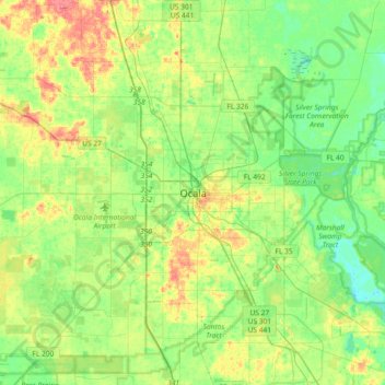
Name: Ocala topographic map, elevation, terrain.

Location: Ocala, Marion County, Florida, 34471:34474, United States (29.02720 -82.30009 29.34720 -81.98009)

Average elevation: 89 ft

Minimum elevation: 16 ft

Maximum elevation: 217 ft

Marion County trails, hiking, mountain biking, running and outdoor activities

Gear up for your next adventure:

🥾Hiking Shoes - Durable and comfortable shoes for trail hiking
🧥Men's Rain Shells - Premium waterproof and breathable jackets for mountain weather
🦶Carbon Trekking Poles - Reduce knee impact on steep descents with ultra-light poles
🎁Geography Themed Gifts - Unique gift ideas for map lovers and geography enthusiasts
📚USA Hiking Guide Books - Top trail guides and map books

As an Amazon Associate, this site earns from qualifying purchases at no extra cost to you.