
Tepehuacán de Guerrero topographic map
Interactive map
Click on the map to display elevation.
About this map
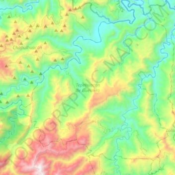
Name: Tepehuacán de Guerrero topographic map, elevation, terrain.
Location: Tepehuacán de Guerrero, Hidalgo, Mexique (20.94560 -98.96407 21.19333 -98.73565)
Average elevation: 2,697 ft
Minimum elevation: 482 ft
Maximum elevation: 7,933 ft