Geolocate

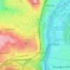
Suresnes topographic map

Click on the map to display elevation.

About this map
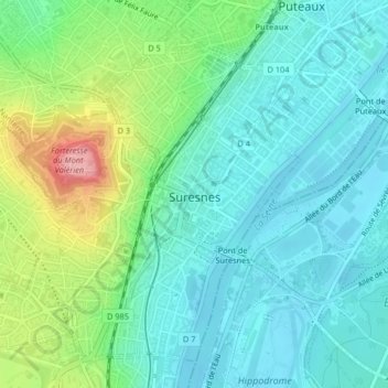
Name: Suresnes topographic map, elevation, terrain.

Location: Suresnes, Arrondissement of Nanterre, Hauts-de-Seine, Ile-de-France, Metropolitan France, 92150, France (48.85939 2.19977 48.88276 2.23679)

Average elevation: 203 ft

Minimum elevation: 85 ft

Maximum elevation: 545 ft

Other topographic maps

Click on a map to view its topography, its elevation and its terrain.
Residence Foch

France > Ile-de-France > Hauts-de-Seine > Garches

Average elevation: 423 ft

Gear up for your next adventure:

🧥Men's Rain Shells - Premium waterproof and breathable jackets for mountain weather
🎒Trail Energy Bars - High‑calorie bars for hiking energy
🔌Solar Panel Charger - Charge gear sustainably outdoors
🍳Camping Cook Set - Complete cookware for outdoor meals
🩳Quick‑Dry Hiking Shorts - Comfortable and quick‑dry shorts for summer hiking

As an Amazon Associate, this site earns from qualifying purchases at no extra cost to you.