
Hof am Regen topographic map
Interactive map
Click on the map to display elevation.
About this map
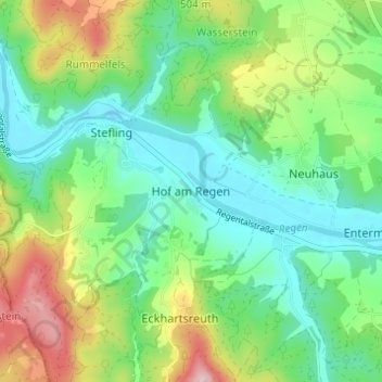
Name: Hof am Regen topographic map, elevation, terrain.
Average elevation: 1,371 ft
Minimum elevation: 1,106 ft
Maximum elevation: 1,936 ft
Other topographic maps
Click on a map to view its topography, its elevation and its terrain.
Gunt
Deutschland > Bayern > Landkreis Schwandorf > Nittenau > Hof am Regen
Gunt, Hof am Regen, Nittenau, Landkreis Schwandorf, Bayern, 93149, Deutschland
Average elevation: 1,391 ft