Geolocate

Marietta topographic map

Click on the map to display elevation.

About this map

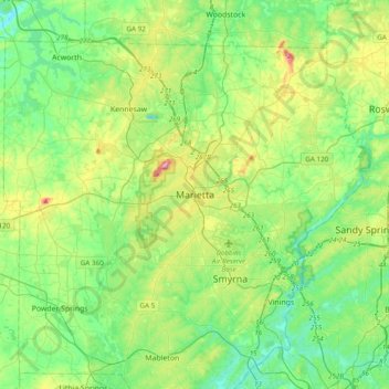
Name: Marietta topographic map, elevation, terrain.

Location: Marietta, Cobb County, Georgia, 30090, United States (33.79285 -84.70961 34.11285 -84.38961)

Average elevation: 991 ft

Minimum elevation: 709 ft

Maximum elevation: 1,736 ft

Cobb County trails, hiking, mountain biking, running and outdoor activities

Gear up for your next adventure:

🎁Geography Themed Gifts - Unique gift ideas for map lovers and geography enthusiasts
🧥Men's Rain Shells - Premium waterproof and breathable jackets for mountain weather
🧦Merino Wool Socks - Moisture-wicking, blister-preventing socks for long treks
🏔️Mountain Trail Maps - High‑detail maps for popular peaks
🦶Carbon Trekking Poles - Reduce knee impact on steep descents with ultra-light poles

As an Amazon Associate, this site earns from qualifying purchases at no extra cost to you.