
Aviemore topographic map
Interactive map
Click on the map to display elevation.
About this map
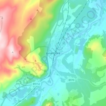
Name: Aviemore topographic map, elevation, terrain.
Location: Aviemore, Highland, Écosse, PH22 1RN, Royaume-Uni (57.15375 -3.86875 57.23375 -3.78875)
Average elevation: 1,086 ft
Minimum elevation: 653 ft
Maximum elevation: 2,333 ft