
Sidi Abderrahmane topographic map
Interactive map
Click on the map to display elevation.
About this map
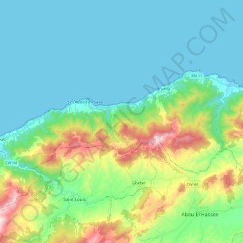
Name: Sidi Abderrahmane topographic map, elevation, terrain.
Location: Sidi Abderrahmane, Daïra Ténès, Chlef, Algérie (36.44293 1.01118 36.51539 1.22189)
Average elevation: 584 ft
Minimum elevation: 0 ft
Maximum elevation: 2,526 ft
Other topographic maps
Click on a map to view its topography, its elevation and its terrain.
Sidi Akkacha
Algérie > Chlef > Daïra Ténès
Sidi Akkacha, Daïra Ténès, Chlef, 02009, Algérie
Average elevation: 968 ft