Geolocate

Colville topographic map

Click on the map to display elevation.

About this map

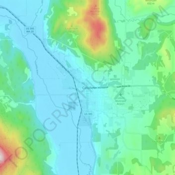
Name: Colville topographic map, elevation, terrain.

Location: Colville, Stevens County, Washington, United States (48.50657 -117.94554 48.58657 -117.86554)

Average elevation: 1,975 ft

Minimum elevation: 1,535 ft

Maximum elevation: 3,875 ft

Stevens County trails, hiking, mountain biking, running and outdoor activities

Gear up for your next adventure:

🍳Camping Cook Set - Complete cookware for outdoor meals
🔌USB Car Charger - Car charger for on‑the‑go power needs
🌧️Backpack Rain Cover - Keep gear dry in wet weather
📦Dry Bags Set - Waterproof storage for electronics and clothes
🪄Magnetic Compass - Accurate compass for navigation

As an Amazon Associate, this site earns from qualifying purchases at no extra cost to you.