
Brodhead topographic map
Click on the map to display elevation.
About this map
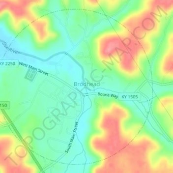
Name: Brodhead topographic map, elevation, terrain.
Location: Brodhead, Rockcastle County, Kentucky, United States (37.39169 -84.43133 37.41592 -84.40088)
Average elevation: 1,030 ft
Minimum elevation: 906 ft
Maximum elevation: 1,211 ft
Rockcastle County trails, hiking, mountain biking, running and outdoor activities
Other topographic maps
Click on a map to view its topography, its elevation and its terrain.