
Engter topographic map
Interactive map
Click on the map to display elevation.
About this map
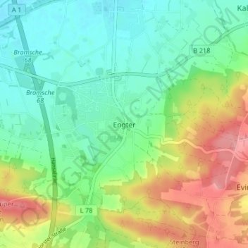
Name: Engter topographic map, elevation, terrain.
Average elevation: 285 ft
Minimum elevation: 161 ft
Maximum elevation: 518 ft
Other topographic maps
Click on a map to view its topography, its elevation and its terrain.
Schleptrup
Deutschland > Niedersachsen > Landkreis Osnabrück > Bramsche > Engter > Schleptrup
Schleptrup, Engter, Bramsche, Landkreis Osnabrück, Niedersachsen, Deutschland
Average elevation: 243 ft