
La atalaya topographic map
Interactive map
Click on the map to display elevation.
About this map
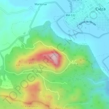
Name: La atalaya topographic map, elevation, terrain.
Average elevation: 892 ft
Minimum elevation: 525 ft
Maximum elevation: 1,890 ft
Other topographic maps
Click on a map to view its topography, its elevation and its terrain.
Embalse del Judío
España > Región de Murcia > Vega Alta del Segura > Cieza > Fuente Ascoy
Embalse del Judío, Ascoy, Fuente Ascoy, Cieza, Vega Alta del Segura, Región de Murcia, España
Average elevation: 879 ft