
Acatlán de Juárez topographic map
Interactive map
Click on the map to display elevation.
About this map
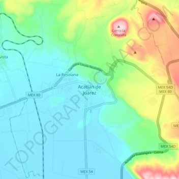
Name: Acatlán de Juárez topographic map, elevation, terrain.
Location: Acatlán de Juárez, Jalisco, 45700, México (20.38197 -103.63168 20.46197 -103.55168)
Average elevation: 4,747 ft
Minimum elevation: 4,432 ft
Maximum elevation: 5,682 ft