
Macapá topographic map
Click on the map to display elevation.
About this map
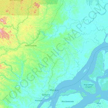
Name: Macapá topographic map, elevation, terrain.
Average elevation: 121 ft
Minimum elevation: -16 ft
Maximum elevation: 1,319 ft
Other topographic maps
Click on a map to view its topography, its elevation and its terrain.
Amazon River
During what many archaeologists called the formative stage, Amazonian societies were deeply involved in the emergence of South America's highland agrarian systems. The trade with Andean civilizations in the terrains of the headwaters in the Andes formed an essential contribution to the social and religious…
Average elevation: 33 ft