
El Amiria topographic map
Interactive map
Click on the map to display elevation.
About this map
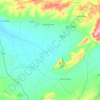
Name: El Amiria topographic map, elevation, terrain.
Location: El Amiria, Sigus District, Oum El Bouaghi, Algeria (35.99471 6.83245 36.14935 7.00380)
Average elevation: 2,920 ft
Minimum elevation: 2,559 ft
Maximum elevation: 4,196 ft