Lawrence topographic map
Click on the map to display elevation.
Lawrence
Lawrence is located at coordinates 38.9716689, -95.2352501 in the state of Kansas, approximately 25 miles (40 kilometers) east of Topeka, and 35 mi (56 km) west of Kansas City, Kansas. Though Lawrence has a designated elevation of 866 feet (264 m), the highest elevation is Mount Oread on the University of Kansas campus with an elevation of 1,020 feet (310 m).
About this map
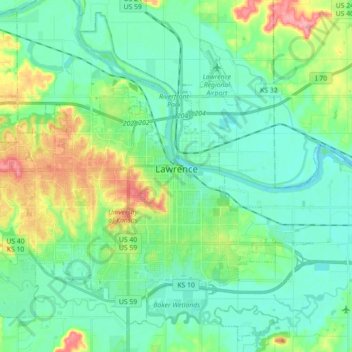
Name: Lawrence topographic map, elevation, terrain.
Location: Lawrence, Douglas County, Kansas, United States (38.90447 -95.34454 39.03350 -95.16662)
Average elevation: 869 ft
Minimum elevation: 791 ft
Maximum elevation: 1,093 ft
Douglas County trails, hiking, mountain biking, running and outdoor activities
Other topographic maps
Click on a map to view its topography, its elevation and its terrain.