
Aïn Thrid topographic map
Interactive map
Click on the map to display elevation.
About this map
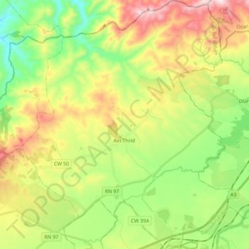
Name: Aïn Thrid topographic map, elevation, terrain.
Location: Aïn Thrid, Daïra Tessala, Sidi Bel Abbès, Algérie (35.22393 -0.74709 35.36139 -0.60122)
Average elevation: 1,673 ft
Minimum elevation: 758 ft
Maximum elevation: 3,048 ft