
Jiménez topographic map
Interactive map
Click on the map to display elevation.
About this map
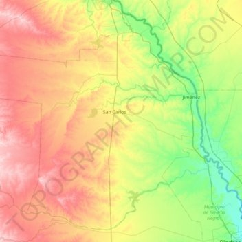
Name: Jiménez topographic map, elevation, terrain.
Location: Jiménez, Coahuila de Zaragoza, México (28.72942 -101.34785 29.28150 -100.64558)
Average elevation: 1,086 ft
Minimum elevation: 712 ft
Maximum elevation: 1,631 ft