
Lo Tsz Tin topographic map
Interactive map
Click on the map to display elevation.
About this map
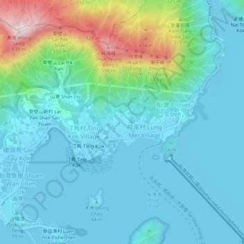
Name: Lo Tsz Tin topographic map, elevation, terrain.
Location: Lo Tsz Tin, Tai Po District, Hong Kong, DD28 974, PRC (22.45438 114.20618 22.49438 114.24618)
Average elevation: 367 ft
Minimum elevation: -10 ft
Maximum elevation: 2,021 ft