
Thank you for supporting this site ❤️
Make a donation
Make a donation
Gear up for your next adventure:
As an Amazon Associate, this site earns from qualifying purchases at no extra cost to you.
Plauen topographic map
Click on the map to display elevation.
Thank you for supporting this site ❤️
Make a donation
Make a donation
Gear up for your next adventure:
As an Amazon Associate, this site earns from qualifying purchases at no extra cost to you.
About this map
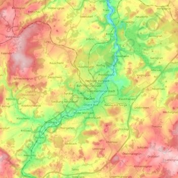
Name: Plauen topographic map, elevation, terrain.
Location: Plauen, Vogtlandkreis, Saxony, Germany (50.43067 12.05941 50.57488 12.22946)
Average elevation: 1,407 ft
Minimum elevation: 984 ft
Maximum elevation: 1,814 ft
Thank you for supporting this site ❤️
Make a donation
Make a donation
Gear up for your next adventure:
As an Amazon Associate, this site earns from qualifying purchases at no extra cost to you.