
Thank you for supporting this site ❤️
Make a donation
Make a donation
Gear up for your next adventure:
As an Amazon Associate, this site earns from qualifying purchases at no extra cost to you.
Riedstadt topographic map
Click on the map to display elevation.
Thank you for supporting this site ❤️
Make a donation
Make a donation
Gear up for your next adventure:
As an Amazon Associate, this site earns from qualifying purchases at no extra cost to you.
About this map
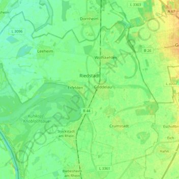
Name: Riedstadt topographic map, elevation, terrain.
Location: Riedstadt, Kreis Groß-Gerau, Hesse, 64560, Germany (49.78484 8.37634 49.88249 8.54962)
Average elevation: 295 ft
Minimum elevation: 266 ft
Maximum elevation: 338 ft
Thank you for supporting this site ❤️
Make a donation
Make a donation
Gear up for your next adventure:
As an Amazon Associate, this site earns from qualifying purchases at no extra cost to you.