
Wanfried topographic map
Interactive map
Click on the map to display elevation.
About this map
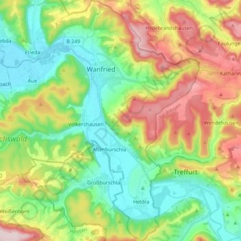
Name: Wanfried topographic map, elevation, terrain.
Location: Wanfried, Werra-Meißner-Kreis, Hessen, 37281, Deutschland (51.11215 10.10573 51.21243 10.23641)
Average elevation: 912 ft
Minimum elevation: 509 ft
Maximum elevation: 1,673 ft