
Laren topographic map
Interactive map
Click on the map to display elevation.
About this map
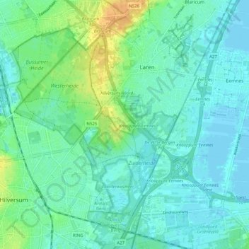
Name: Laren topographic map, elevation, terrain.
Location: Laren, Noord-Holland, Nederland (52.21213 5.18885 52.27291 5.24509)
Average elevation: 26 ft
Minimum elevation: -7 ft
Maximum elevation: 92 ft
Other topographic maps
Click on a map to view its topography, its elevation and its terrain.
Westerheide
Nederland > Noord-Holland > Laren
Westerheide, Laren, Hilversum, Noord-Holland, Nederland
Average elevation: 43 ft
De Witte Bergen
Nederland > Noord-Holland > Laren
De Witte Bergen, Laren, Noord-Holland, Nederland
Average elevation: 16 ft