Geolocate

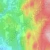
Greenfield topographic map

Click on the map to display elevation.

About this map
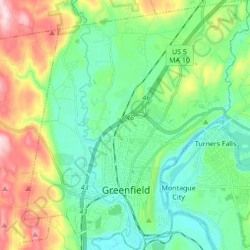
Name: Greenfield topographic map, elevation, terrain.

Location: Greenfield, Franklin County, Massachusetts, 01301, United States (42.56621 -72.64993 42.65595 -72.53996)

Average elevation: 384 ft

Minimum elevation: 85 ft

Maximum elevation: 1,096 ft

Franklin County trails, hiking, mountain biking, running and outdoor activities

Other topographic maps

Click on a map to view its topography, its elevation and its terrain.
Fort Lucas

United States > Massachusetts > Franklin County

Average elevation: 876 ft

Mount Hermon

United States > Massachusetts > Franklin County > Gill

Average elevation: 325 ft

Bear Swamp

United States > Massachusetts > Franklin County > Ashfield

Average elevation: 1,509 ft

Shelburne

United States > Massachusetts > Franklin County

Average elevation: 873 ft

Mount Ram

United States > Massachusetts > Franklin County

Average elevation: 577 ft

Pitt Hill

United States > Massachusetts > Franklin County > Orange

Average elevation: 955 ft

Mount Hermon

United States > Massachusetts > Franklin County > Gill

Average elevation: 325 ft

Gear up for your next adventure:

📚Navigation Handbooks - Master the art of reading topographic maps and using a compass
☀️Outdoor Sunscreen - High protection sunscreen for outdoor activities
🥩Freeze-Dried Meals - Nutritious and lightweight food for remote expeditions
🗺️NatGeo Topo Maps - High-quality waterproof printed topographic maps of US Parks
☕Camping Coffee Makers - Enjoy premium coffee at the summit or campsite

As an Amazon Associate, this site earns from qualifying purchases at no extra cost to you.