
Khanapur topographic map
Interactive map
Click on the map to display elevation.
About this map
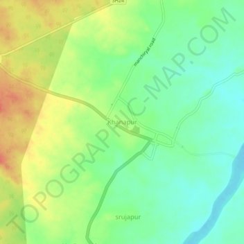
Name: Khanapur topographic map, elevation, terrain.
Location: Khanapur, Khanapur mandal, Nirmal, Telangana, 504203, India (19.02422 78.62472 19.06422 78.66472)
Average elevation: 810 ft
Minimum elevation: 738 ft
Maximum elevation: 909 ft
Other topographic maps
Click on a map to view its topography, its elevation and its terrain.