
Ouled Saïd topographic map
Interactive map
Click on the map to display elevation.
About this map
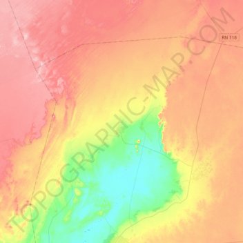
Name: Ouled Saïd topographic map, elevation, terrain.
Location: Ouled Saïd, Daïra Timimoun, Timimoune, Algérie (29.31693 0.10222 29.54549 0.47787)
Average elevation: 1,014 ft
Minimum elevation: 659 ft
Maximum elevation: 1,329 ft