
Holíč topographic map
Interactive map
Click on the map to display elevation.
About this map
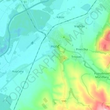
Name: Holíč topographic map, elevation, terrain.
Average elevation: 620 ft
Minimum elevation: 505 ft
Maximum elevation: 1,099 ft
Holíč lies at an altitude of 185 metres (607 ft) above sea level and covers an area of 34.784 square kilometres (13.4 sq mi). It is located in the Záhorie region near the Morava River, 6 kilometres (4 mi) away from the Czech city of Hodonín and around 85 kilometres (53 mi) from Bratislava.