Unter der Hardt topographic map
Interactive map
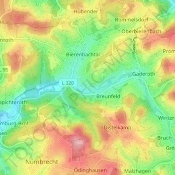
Click on the map to display elevation.
About this map
Name: Unter der Hardt topographic map, elevation, terrain.
Average elevation: 876 ft
Minimum elevation: 663 ft
Maximum elevation: 1,129 ft

Click on the map to display elevation.
Name: Unter der Hardt topographic map, elevation, terrain.
Average elevation: 876 ft
Minimum elevation: 663 ft
Maximum elevation: 1,129 ft