
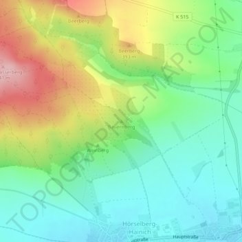
Bauernberg topographic map
Interactive map
Click on the map to display elevation.
About this map
Name: Bauernberg topographic map, elevation, terrain.
Average elevation: 1,129 ft
Minimum elevation: 928 ft
Maximum elevation: 1,476 ft
Other topographic maps
Click on a map to view its topography, its elevation and its terrain.
Rabenberg
Deutschland > Thüringen > Wartburgkreis > Hörselberg-Hainich
Rabenberg, Hörselberg-Hainich, Wartburgkreis, Thüringen, 99848, Deutschland
Average elevation: 1,388 ft