
Burkersdorfer Weg topographic map
Interactive map
Click on the map to display elevation.
About this map
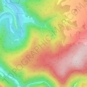
Name: Burkersdorfer Weg topographic map, elevation, terrain.
Average elevation: 1,588 ft
Minimum elevation: 912 ft
Maximum elevation: 2,218 ft
Other topographic maps
Click on a map to view its topography, its elevation and its terrain.
Tanzbuche
Deutschland > Thüringen > Landkreis Saalfeld-Rudolstadt > Schwarzburg
Tanzbuche, Schwarzburg, Schwarzatal, Landkreis Saalfeld-Rudolstadt, Thüringen, 07427, Deutschland
Average elevation: 1,355 ft
Schloßberg
Deutschland > Thüringen > Landkreis Saalfeld-Rudolstadt > Schwarzburg
Schloßberg, Schwarzburg, Schwarzatal, Landkreis Saalfeld-Rudolstadt, Thüringen, 07427, Deutschland
Average elevation: 1,306 ft